Denver’s Hale neighborhood is an historic community tucked between Colorado Boulevard and Holly Streets to the west and east, respectively, and Colfax Ave. and 6th Ave. to the north and south. This relatively quiet area is fairly unique in that the north/south grid is diagonally distinguished by a tree-lined, two-lane, median-separated stretch of picturesque road called Hale Parkway.
Gone But Not Forgotten
Development in the area began in the 1930s and, as geography would have it, a creek flowed on a northwest/southeast angle through marshland along the path where Hale Parkway now exists. The creek was part of the Upper Montclair Basin runoff system, directing rainwater toward the Platte River basin to the northwest. By the 1940s, the area was developed, and the old riverbed was wiped away and soon-to-be forgotten by residents, but not by topography. When heavy rainfall hits the area, the one-time natural waterway can be quickly transformed into a saturated urban thoroughfare with flood levels up to three feet high.
A Diagonal Asset
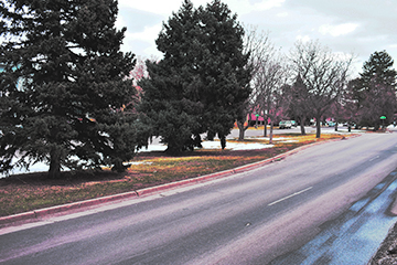
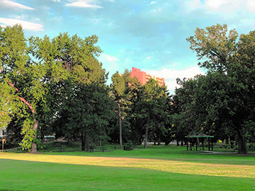
Today, the marshlands have been replaced by mostly residential structures along with the significantly large Rose Medical Center and University of Colorado Hospital campuses. Hale Parkway is a local treasure, boasting a series of lush, park-like medians that are home to a total of 80 large, mature trees and 40 smaller trees and shrubs. Hale Parkway is one of just 35 designated parkways and boulevards across the Mile High City recognized as such by the Denver City government. This stretch of road gives the community a distinctively quaint feel, as its diagonal trajectory works as a cohesive, common feature which unites the neighborhood.
An Extreme Scheme
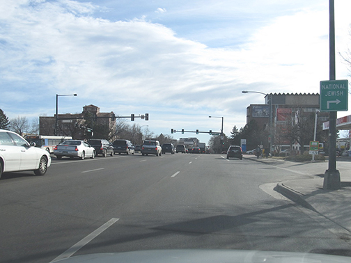
The redesign project proposed by the Urban Drainage and Flood Control District (now the newly-branded Mile High Flood District [MHFD]) holds drastic measures for the parkway. These initiatives which would effectively diminish the purpose and function of the roadway and the appeal of the area at large. The plan calls for the permanent removal of the two north lanes carrying traffic west from 8th Avenue to Colorado Blvd. The removal of features would also include the grassy park-like medians, all flora and foliage therein as well as several dozen parking spaces (65 total) for area residents. A series of large drainage pipes would replace the lanes, spaces and medians while east/west traffic would be funneled to side-by-side opposing lanes in place of the two existing eastbound lanes. Local property owners are highly upset that the redesign would severely diminish real estate values. Meanwhile, the explosive growth of the area has residents at large concerned with an imminent traffic congestion problem. As the number of inhabitants is set to increase, the redesign would decrease the area’s ability to effectively accommodate all the new traffic.
Violation Of Internal Rules
Further, the proposed measures are in blatant breach of the Denver Design Guidelines published by the City and County of Denver in 2005. Page 14 of the guide pledges to “Respect and preserve the historic or original design of the parkway or boulevard. Components of the original design usually include the street cross section, tree lawn, median (if appropriate), adjacent street pattern, building setback and private yard, building siting, topography and plantings.” Also, a subsequent section claims that the city will “Preserve the spaces and relationships that are part of the original or historic parkway or boulevard construction including the continuous open space created by the building setback.” Clearly, the MHFD is proposing to infringe on the very rules set by its parent authority — the Denver City Government.
Plausible Alternatives?
With the Cherry Creek waterway located just two miles to the south and flowing northwest to the Platte River, it would seem that returning an unassuming one mile stretch of road in Hale to its former watershed function is inconsequential. Some residents are imploring MHFD to consider alternative means of managing rainwater overflow in the area. Others are outraged, seeing the beauty-sacrificing redesign as a grossly lopsided and ultimately futile misappropriation of taxpayer funds. Aligning with this viewpoint is not difficult. Driving through Hale trying to visualize the proposed measures put into place is like imagining a jagged, diagonal tear through the cross stitchings of a gorgeous tapestry; unsightly, unnecessary, and utterly without purpose.